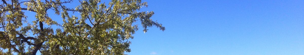
Once outside Zafra, the route climbed steadily to a ridge overlooking Los Santos de Maimona. From the summit, one could see the plain stretching to distant mountains. Mérida lies 65 km to the north of Zafra and takes three days of walking, spending the nights in Villafranca de Los Barros and Torremejía. Once again, between the overnight villages, there was nothing but occasional farmland and bush.
Looking down on Los Santos de Maimona
The land was parched. It looked as if it had not seen rain for a long time. At one time, after Santos de Maimona, we came across of a flock of sheep. The shepherd walked ahead, seemingly oblivious of what was following him. Four sheep dogs raced around, rounding up the stragglers and keeping the flock moving in the general direction of their master. It was not the first time that I have witnessed the shepherd-to-dog relationship, and I have never ceased to be impressed.
The shepherd leaving, the flocking following
From Villafranca de los Barros to Torremejía the path was straight, following the old Roman road. There is absolutely no shade, just grape vines and occasional olive groves as far as the eye can see. In one part, the road was being resurfaced, and for several kilometres we had to trudge through a thick layer of uncompressed dust.
A repaired through the vines
On a long straight path, with no bordering trees or bushes, one’s progress across the landscape is barely perceptible. The goal is there on the horizon, but on the horizon is where it seems to remain.
In the distance Torremejía
But eventually one arrives.
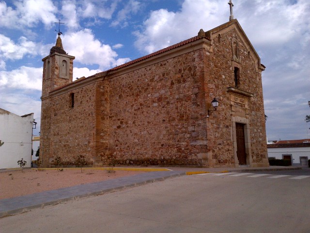
Grapes on their way to being pressedThe recently renovated Iglesia Parroquial in Torremejía
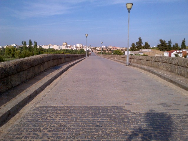
The next day was relatively easy and, in the early afternoon, we arrived at the Puente Romano, that leads across the river Guadiana to Mérida.
At 790 m, it is the longest surviving Roman bridge.
The Puente Romano over the river Guadiana, with its 60 surviving spans
We were not long back from our four months in Chamonix, when I started to plan our next long hike along one of the pilgrimage paths that eventually arrive in Santiago de Compostela. My mind was set on walking across France, from Geneva to Saint-Jean-Pied-de-Port, via Puy-en-Velay. I booked flights from Stockholm for 28 September and started to plan the stages of the walk.
But I had nor progressed very far in my planning, before I realised my potential mistake; we would be crossing the Massif Central, the mountainous south-central part of France, in late October, when the weather could be quite cold. And as I don’t ‘do’ cold, I switched my attention to the Vía de la Plata, that starts from a much more temperate Sevilla. And conveniently there was a low-cost morning flight from Geneva to Sevilla on 29 September.
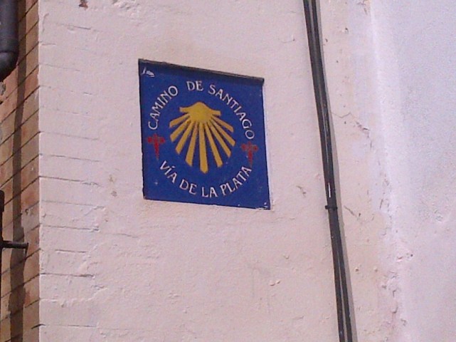
The Vía de la Plata is the longest of the pilgrimage routes in Spain, heading north from Sevilla to Zamora, then north-west to Santiago, a total distance of about 1000 km. Much of the route is on ancient Roman roads. The route was also known as the Camino Mozárabe, originally followed by the Christians of North Africa.
Vía de la Plata
I was no stranger to the route from Sevilla. In mid-February of 2015, I had set out to walk from Sevilla. The temperature was perfect for hiking, but my start was delayed for nearly a week by torrential rain. When I eventually got going, I found low-lying areas to be flooded, streams with stepping stones to be deep under water, and mountain paths washed out. Twice I slipped and fell in the water, and when I reached Villafranca de los Arroyos, the heavy rains started again. The forecast was for rain, rain and even more rain for the week ahead and extensive flooding. I decided to abandon the walk and return another time.
My second attempt was in late September of the same year, but this time it was in soaring temperatures and with little or no shade. When I walked into Mérida the temperature was 42 °c. The heatwave showed no sign of abating, so I once more stopped.
But ‘Stubborn’ is my middle name and back to Sevilla I went once more, this time with Lotta. It was her first time in Sevilla, so we spent the first day seeing some of the sights.
The central core of Sevilla is a labyrinth of narrow streets branching out from the massive cathedral. Some of the lanes are so narrow that one can stretch out ones’ arms and almost touch the walls on each side. The lanes twist and turn, and despite being close to the cathedral, one cannot see it until one exits the maze.
The cathedral is the third-largest church in the world and is the burial site of the alleged bones of Christopher Columbus. It has fifteen doors on its four facades. It is so extensive that it can only be seen in its totality from the air.
Part of one of the facades of the cathedral
Sevilla is a popular tourist destination, for it is an interesting scenic and historic city. But one of the downsides of exploring the tourist area is being the constant target of touts trying to entice one into restaurants, sell tickets to flamenco shows, rides in a carriage etc.
Coches de Caballo – Rather expensive tourist traps
One of the largest buildings ever constructed in Europe was the Royal Tobacco Factory. It measures 250 m by 180 m and was built in the mid-eighteenth century. It was the first tobacco factory in Europe. Since the 1950s, it has housed part of the University of Seville.
The Royal Tobacco Factory (picture from internet)
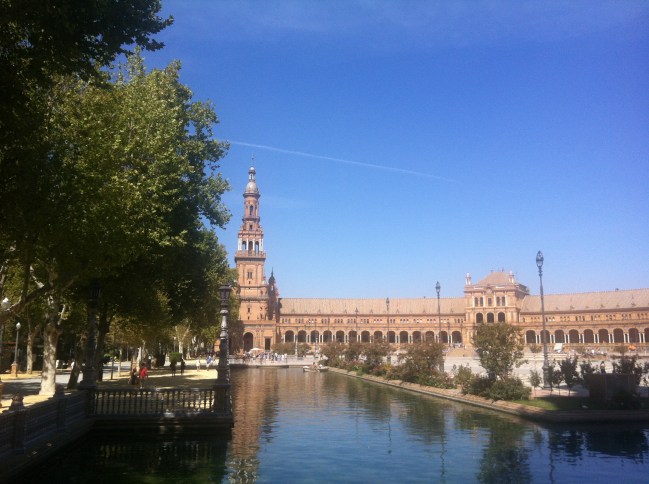
The magnificent Plaza de España was built in 1929 and was the central feature of the Ibero-American Exposition, held to strengthen the ties between Spain, Portugal and their former colonies. The building is semi-circular and features a canal crossed by several ornate bridges.
A view of one of the symetric ends of the building
And one of the pairs of bridges crossing the canal
The building has 58 pairs of benches, each one representing a province of Spain, with a typical scene from the province and a map, all surfaced in painted ceramic tiles.
And at the end of the day, a timely reminder of why we were in Sevilla…