Bertie Peacock

When I was a teenager, Bertie Peacock was a hero and idol in my part of Ireland.  He was born in Killowen, in Coleraine, played a few games for the local football club in 1947, before being transferred to Glentoran, in Belfast, and on to Glasgow Celtic in 1949.  There he made 450 appearances, together with 31 caps for Northern Ireland during 1952-62.  He played in the 1958 World Finals in Sweden, when Northern Ireland reached the quarter-finals, a feat not since repeated.

GW418H619
Bertie Peacock in his Glasgow Celtic days

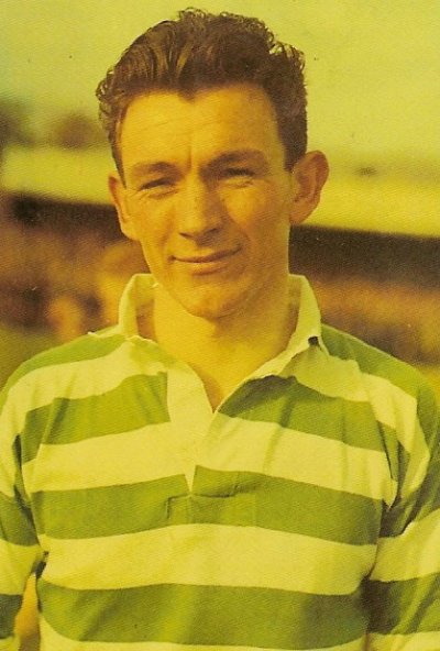
In 1961, he returned to Coleraine as player/manager, culminating with winning the Irish Cup in 1965, at which I was present.  Soon after, I migrated to Canada and lost touch with the exploits of the team, which had several more cup and league successes.  Bertie retired in 1970, continued for a few years as manager, and eventually bought a local pub, which he named  as ‘Bertie’s Bar’.  He died in 2004.

When I recently visited the Coleraine graveyard, my brother showed me Bertie’s grave.  He told me that there was now a statue of Bertie in the Diamond in the town.

It was my great-uncle Bill and Ronnie Wilson who first took me to see a Coleraine football match.  Apart from the once-a-year North-west 200 motor cycle race and the horse racing in the fields beside Hopefield hospital, there was only local football to watch.  Television was in its infancy and, apart from the FA Cup final, no football was broadcast live.

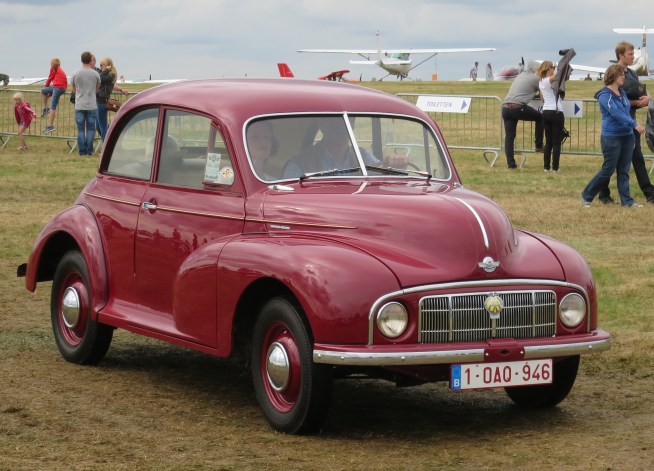
Ronnie used to work with my father.  He was a few years older than me, and Uncle Bill used to drive us the four miles to Coleraine in his little Morris Minor 1000.  Uncle Bill used to set off more than an hour before the kick-off, despite that there was never a crowd capacity of much more than 2000.  We used to race along at about 30 mph, only slightly faster that uncle Bill would have driven his horse and cart; there was always a long line of reluctant followers behind us.  He always parked in the same spot on Union Street.  And the ground was practically empty when we took the same seats on the back row at the corner of the stand.  Sometimes we had to wait outside until the man who operated the turnstile arrived.  We never missed a kick-off.

Morris_Minor_MM_(low-lights)_1950_moving
A Morris Minor 1000 – Uncle Bill’s was black

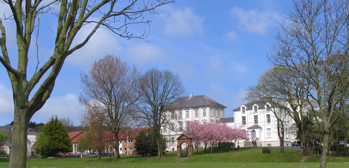
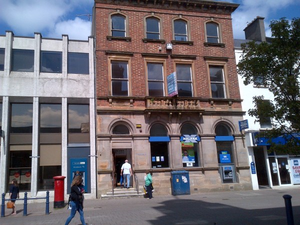
My brother dropped me off near the town centre and I strolled the rest of the way along the pedestrian mall.  The town centre that I remembered had much changed; it had been extensively rebuilt after the IRA bombings in the 1970’s.  I stopped opposite the building where I used to work and took a photo of it.  The quantity surveyors that I worked for – Dalzell & Campbell, probably no longer exists.

IMG-20170502-00149
My desk was at the window on the first floor, above the entrance


Close by, was the statue of Bertie Peacock, and reading the attached plaque was an older man.  We started to talk, as do most Irish.  I asked him what all the flags around the town were in mourning for.  He told me that they had been put up to celebrate Coleraine being in the Cup Final on the coming Saturday.  When I remarked that they all seemed to be in mourning at half-mast, he laughed and said that the men who put up the flags only had a short ladder.

IMG-20170502-00150
Johnny McCurdy reading the plaque, before I spoke to him

It turned out that the man I was talking to used to play football and he had known Bertie Peacock.  Not only that, he used to play for Coleraine.  And to cap it all, he played in the Cup Final of 1965, which was the last game I saw, before I migrated to Canada.  I was talking to Johnny McCurdy, the famed defender of the sixties and seventies, who still holds the club record for appearances at 634.  After he retired from playing, he managed the club for a time.

pic12
Johnny McCurdy as the victorious captain, with club chairman, Jack Doherty (photo from internet)

We chatted for a long time about this, that and the other, and when we went on our separate ways, I felt as if I had never been away, and that all my wandering for the past fifty-two years had been but a dream.  It was the same strong feeling of nostalgia that I always experience when I revisit my home country; of memories of happy and perhaps simpler times, tinged with a sadness that those days are gone forever, together with most of the people that I once knew.

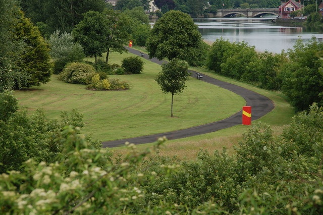
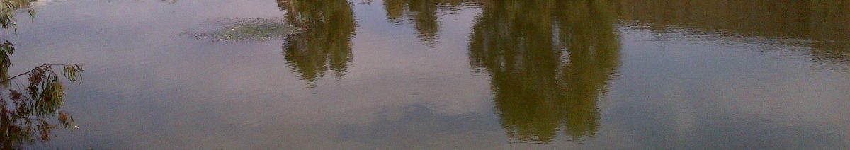
I crossed the bridge and walked slowly back to my hotel, along the beautiful riverside walk.

Ti
Part of the riverside walk (photo from internet)


George

Since my father died in 1995, I have not often been back to Ireland, in fact only in 2004, and again about eighteen months ago.  The north Antrim coast, from whence I come, is not on the way to anywhere; it is about as far as one can get from civilisation, unless one is sailing north to remote Scotland, the Faroe Islands or Iceland.  And once landed at Belfast airport, there awaits an hourly bus service to Antrim and an hourly train to Coleraine, both of which I always seem to manage to miss by no more than five minutes.

But when I step foot back on Irish soil, all the frustrations and aggravations of modern travel and living seem to evaporate, and I completely relax; I am once more 18 and on my way home again.

I met my brother the next morning at my hotel, and we headed off to the graveyard; I was anxious to visit the grave of an old friend, George.  We worked together in Coleraine in the mid-1960s.  He migrated to Toronto in 1965, together with his fiancée, Eileen.  They wanted to marry, but being of mixed religions, migration was their perceived solution.  George had a cousin in Toronto, and soon after they arrived, George and Eileen were married.  As crazy as it may seem today, that was the experience of many young Irish couples in that era.

George & Eileen

I followed soon after George and Eileen, and spent a few weeks sleeping on their living room floor.  None of us had much money and my contribution to the household was much welcomed. Eventually I moved in with five other guys, at 345 Eglinton Ave West –  Howard Abrahams, Michael Goldberg, Robin Jackson, Bill Stott and a Canadian, Gordie.  I am still in touch with Howard and Michael; Robin died a long time ago in South Africa; with the other two I have had no further contact, although I was once told that Bill did end up as the global boss of Hallmark Cards,

George worked as an estimator for a construction company – Pigott Construction, and later, he introduced me to his boss, who offered me a job, which I accepted.  Outside of work, I saw little of George socially; he was a settled suburban husband and I was a lad-about-town, playing rugby, football and partying.

Before I left for Australia in 1971, I last saw George and Eileen.  At that time, they had a little girl.  They seemed to be very happy and very much in love.  That was our last contact.

After I had a stroke in late-2005, it took some time, perhaps 2-3 years, for me to realize that my memory had not completely recovered.  I stumbled upon my own method of revitalising it – one day I may write of that difficult period of my life, and in so doing, I tried to find George.  Telephone directories, linkedin.com, facebook.com, internet etc. – there was no footprint.  I eventually dismissed him as being as a ‘Luddite’, resistant to new technology.

Until my good friend and genealogist, Norman Calvin, found him for me, or rather, found his sister.  And there I was, with my brother, looking for George’s grave.  It was no wonder that I had not been able to find him.  He came upon hard times in Toronto.  He lost his job, divorced and lost his family.  He eventually returned to Coleraine, but his situation did not improve.  On 25 November 2005 he died, a broken man.  On that day, I was fighting for my life in an intensive care ward of a hospital in Stockholm.

But where was his grave?  I had a rough idea where it was, but there were so many.  We split up, one each side of a path.  We walked up and down the rows, until I was on the point of giving up and getting more precise directions.  I distinctly remember saying out loud, ‘George, where are you’, when, in that instant, my brother shouted, ‘Over here’.

IMG-20170501-00142

It was another of the many co-incidences in my life.

Jimmy

James Bankhead was a quite tall slim man with fair hair.  Before he bought his first car, he used to regularly walk into Portrush.  He had a very long loping stride and in a few steps he was over the crest of the hill and out of sight.

He was married to ‘Nan’ Stewart, a childhood friend of my mother.  They lived in the big schoolhouse, next door to our farm, and he was headmaster at Carnalridge Primary school, no more than fifty meters from his front door.

Between the schoolhouse and the school lived a very strange old man.  He had unkempt hair and a long grey beard, and must have belonged to a religious sect, for he had a sign in his garden declaring ‘Repent, for the Kingdom of God is nigh’, or something similar.

The old man’s house was so small, it could only have consisted of one tiny room.  His garden was a large patch of bog, in which the only thing that grew were rushes.  The old man was rarely ever seen.  As a child I was afraid of him.

Carnalridge school was originally established in 1850 by the congregation of the Presbyterian church.  When I first attended the school in 1953, it consisted of just two rooms, a recently built extension for infant children, plus a dining room and catering facilities.

Carnalridge school
Carnalridge Primary School

There were three teachers – Miss Moore, who looked after the infants, Miss ‘Old Biddy’ McCartney, who was my first teacher, and James ‘Jimmy’ Bankhead, who taught the older children, until they left for the secondary schools.  I don’t know how many pupils there were in that era, but my guess is that there were about 60 altogether.

My earliest memory of the school was the morning of my first day.  We had to stand around the room, with backs to the wall and give our names. The little girl beside me wet her pants and stood in a large puddle of urine. I feel sure that she has never forgotten the embarrassment that she must have felt.

In my last year, there were only four of us who took the ‘Eleven Plus’ examination, that determined whether we would go on to a grammar school, a technical college, or to an intermediate school, which was little more than a holding pen, until the children could leave at age of 15.

Three of us went on to the grammar school in Coleraine, all in the ‘A’ stream, which was a tremendous compliment to the teaching skills of James Bankhead.  In addition to me, there was David Hunter, who ended up studying law at Oxford, and who became a barrister in Belfast, and Michael Moore, who ended up with a PhD in Marine Biology. The fourth pupil was Joan Gurney, but I don’t know what happened to her.

James Bankhead was born in Ahoghill, in 1906, the son of Samuel and Jane Bankhead.  He started his teaching career in Clooney Primary School, in the Waterside area of Londonderry, where he was an assistant teacher for 5 years.  He was appointed principal of Carnalridge in 1932, and remained there until his retirement in 1966.

James Bankhead

He was a man of many talents and diverse interests.  He was a renowned horticulturist, specializing in growing and studying daffodils, and wrote many articles on the subject.  He was a local pioneer in the field of radio and television.  He built his own radio in 1939 and took it to the church to hear the declaration of war.  He built one of the first television sets in the area, and invited local people to his house to see the coronation ceremony in 1953.  He was an accomplished tenor soloist and sang with the church choir.  He was a keen golfer and bowler.  He was an accomplished mathematician and read widely.

My years in his class were some of the best years of my youth.  He taught me in arithmetic and I loved it, and my love of mathematics endures to this day.  He introduced me to the classical  books in the small school library and I borrowed and read most of them: Children of the New Forest, Treasure Island, The Black Arrow, the Enid Blyton books, Robinson Crusoe, among many others. He talked often about the history and geography of our area.

It was James Bankhead who introduced us to cricket, and in our lunch breaks, when the weather was favourable, we used to play, and he always joined in.

Cricket became a passion with me, especially after he showed me a game being played on his television.  I used to spend hours bowling against a wicket placed against the end of our house, and I made up different ways of keeping score.

In about 1986 I visited him.  He was living in a bungalow on the edge of Portrush, on the Ballywillan Road.  His wife had previously died in 1977 and he had remarried to her sister, Lily, who had been living with them in their later years.

I spent a very enjoyable and memorable couple of hours with them, sipping on sherry, and chatting about old times.  I asked him where he had found all the fascinating historical facts about Portrush and the area, history that used to enthral me.  He remembered the book and the author, but regretted that he did not have a copy, otherwise I felt sure he would have given it to me.  It was not until recent times that I discovered a complete transcript of the book on the internet.

Before I left him, I took the opportunity to do something I had wanted to do for many years.  I told him what a great influence he had been on me.  I thanked him for having given me such a good grounding and fostering my interest in a diverse range of subjects.  It was an emotional moment for me and I suspect it was also for him.  He was already an old man at that time, and shortly after, he had a stroke.

He and Lily spent their last days in an old people’s home in Portrush.  He died in 1992 and was buried beside Nan, just outside the door of the ruined church at Ballywillan.

DSC00031

Lily died some time later and was buried in the new graveyard, across the road from the old church.  I have always thought that Jim and Nan would have wanted her to be buried with them.

Coleraine

The earliest known settlement in Ireland was found at Mountsandel Fort, about one mile from the centre of present day Coleraine.  It was there where nomadic hunter-gatherers built their shelters in about 7000 BC.   Dating from about 4000 BC, there is much evidence of Neolithic Man in the area, such as the stone tomb at Magheraboy and the standing stone at Carnalridge.

Coleraine is reputed to have received its name when St Patrick passed through around 450 A.D. Popular tradition states that the Saint was given a piece of land by the local chieftain on which to build a church. The ground was covered with ferns, and so he called it “Cuil Rathain”, which means the ferny corner. Again, authorities differ in this, some asserting the meaning to be “the rath at the bend of the waters”. Over the centuries the name was anglicized and became “Coleraine”.  It is believed that the first church, or monastery, was in the same location as the present St. Patrick’s Church.  The earliest record of Coleraine occurs in Adomnán’s ‘Life of Saint Columba’, written on Iona, circa 700.

Located at the lowest fordable point of the river Bann, Coleraine suffered repeated devastation by competing tribes, by the Vikings in 830 AD and by the Normans in 1177.  It was not until the end of the 16th century that the Ulster tribes were subdued.  In 1610 the first settlers arrived to rebuild Coleraine.  Fortifications were erected and the town was laid out in its present form.

clip_image001
Coleraine in 1613

In 1642 the dispossessed Irish rebelled and for six weeks laid siege to the town, during which 2000 of the inhabitants died of disease and famine, many of them having fled from the countryside seeking protection.   The siege was broken by the arrival of a Scottish army. In 1689, when the invading army of James II approached the town, the people fled to Derry, where they again suffered siege and famine. James II was eventually defeated at the Battle of the Boyne.

As a result of the devastation of the countryside, poverty was widespread and over the next 200 years there was a steady exodus of locals to the New World. There was continued threat of uprising and there was much suffering as a result of the serious outbreak of cholera in 1832 and the Great Famine of 1840-46.

clip_image002

Possibly due to the lack of local opportunities, there was a strong tradition of young men enlisting in the military and many local men fought in the Crimean, Boer and the two world wars.  The Battle of the Somme had a particularly devastating effect on the area and there was scarcely a household that did not lose a family member, as witnessed by the long list of names on the local war memorials.

In 1844 a new stone bridge was built across the river and in 1855 the current town hall in the Diamond was built. The town also became an important centre of the linen industry and textile and shirt-making industries expanded.  In 1888 the river was dredged and piers built, allowing the passage of ships to Coleraine harbour.

In 1968 the new University of Ulster was opened between Coleraine and Portstewart and the influx of students provided a much-needed new source of income to the providers of accommodation, suffering as a result of tourists going to warmer climates for their holidays.

Like much of Ulster, Coleraine suffered from ‘The Troubles’.  In 1973 an IRA car bomb killed six, in 1992 a car bomb exploded in the town centre and in 1995 a massive explosion devastated the entire centre of the town.

clip_image003
The Diamond with its town hall as it is today

A grammar school in Coleraine was first proposed in 1846, but the plan was shelved, die to the economic crisis resulting from the Great Famine.  Coleraine Academical Institution (C.A.I.) was finally open in 1860, with two masters and 14 boys. The number of students peaked at about 1100 in the 1970s and has since been reduced to 700.

clip_image004
Coleraine Academical Institution, now known as Coleraine Grammar School

The school includes 27 acres of sports fields, including rugby and football pitches, tennis courts, cricket pitches, an athletics track, a swimming pool, a games hall with multi-gym equipment and a boathouse.

clip_image005
James Nesbitt – actor

clip_image006
Andrew Trimble – Ulster & Ireland rugby

Two well-known C.A.I. Old Boys

Boarding, which was a feature of the school since its beginning, reached its peak in the 1970s with 300 boarders, but since then it went into decline, and the boarding department was closed in 1999.

In 2015 the all-boys C.A.I was merged with the all-girls Coleraine High School, to become Coleraine Grammar School.

Just past the school, off the Castlerock Road, was the farm of my maternal grandmother’s family.  Her ancestors had farmed the land since at least the early 1800s.  Unfortunately, there are very few records that have survived from before the mid-1800s, so the tracing of Irish ancest0rs soon meets a dead-end.

Kilcranny House
Kilcranny House

My great grandparents had eight children, seven girls and only one boy.  I guess that the only son did not want to be a farmer, and the farm was eventually sold.  The only son died when he was only 48.

12657362_10153737268401187_2528021050712097151_o

Today some peripheral buildings have been added to Kilcranny House, which now belongs to an organization that promotes much-needed peace and reconciliation.

I suspect that the organization would have had my ancestor’s approval.


The Causeway Way

The Causeway Way is a long distance path of some 50 km, that starts near Portstewart, at the mouth of the river Bann, and ends at Ballycastle.  It passes through Portrush, Dunluce, Bushmills, the Giants Causeway, White Park Bay and the famous Carrick-a-Rede rope bridge.

The North West 200 is a motorcycle race meeting held each May.  It is run over public roads between the towns of PortstewartColeraine and Portrush (the Triangle)  and is one of the fastest in the world, with speeds in excess of 200 mph (320 km/h).  In practice for the 2012 event Martin Jessop was clocked at 208 mph (335 km/h).  The first meeting was held in 1929.  It is the largest annual sporting event in Ireland, attracting over 150,000 visitors for the weekend.

There have been 16 deaths since the event was first held, with three in one day in 1979.

clip_image001

The path of the Causeway Way follows the northern leg of the NW200.  My father’s farm was on the road,  just south of Carnalridge.

At the edge of the headland at Portrush, between the port and the recreation grounds is a disused quarry, in which is today located a water amusement park.  Originally it is believed that this was the site of Portrush castle which, together with the church, was ransacked and destroyed by the army of General Munroe in the late 1600s.  It was later demolished to create the walls of the harbour.

It was Richard Óg de Burgh who built the first castle at Dunluce, on the cliffs adjacent to the White Rocks, near Portrush.  The castle was first documented in 1513, as being in the hands of the McQillan family. They were Lords of Route from the late 13th century, until they were displaced by the McDonnells in the late 15th century.

In 1588 the Girona, a galleass from the Spanish Armada, was wrecked on nearby rocks in a storm. Of the 1300 men on board, only nine survived, and were eventually transferred to relative safety in Scotland. About 260 bodies were washed ashore.  In 1967-8 a team of divers located the wreck and much treasure and other valuable items were recovered and are currently held at the Ulster Museum in Belfast.

Following the Battle of the Boyne and the defeat of James I in 1690, the McDonnells were impoverished, and since that time the castle deteriorated and parts were scavenged to serve as materials for nearby buildings.

clip_image001

In 2011, major archaeological excavations found significant remains of the “lost town of Dunluce”, which was razed to the ground in the Irish uprising of 1641. Lying adjacent to Dunluce Castle, the town was built around 1608 by Randall MacDonnell, the first Earl of Antrim, and pre-dates the official Plantation of Ulster.  It may have contained the most revolutionary housing in Europe when it was built in the early 17th century, including indoor toilets which had only started to be introduced around Europe at the time, and a complex street network based on a grid system.  95% of the town is still to be discovered.

Bushmills is a village some 8 km east of Portrush, along the coastal road.  The river Bush passes through the village.  It is home of the world-famous Bushmills Whiskey.  There used to be five distilleries in the region, but only one now survives.  The distillery draws its water not from the river Bush, but from one of its tributaries, Saint Columb’s Rill.

clip_image002

King James I granted a licence to distil in the area in 1608 and Bushmills claims to be the oldest licenced in the world.  In 2005 the company was acquired by Diageo, but now is in the process of changing ownership with José Cuervo.

clip_image003

Close to Bushmills is the Giant’s Causeway, an area of basalt columns that descend into the sea.  The Scottish island of Staffa has similar rock formations.  There are approximately 40,000 columns, typically with five to seven sides and measuring up to 25m in height.

clip_image004

When we moved in to the new house at Islandflackey in the early 1950s, my mother bought a load of five-sided causeway stones, to use in her garden as borders.  I cannot imagine that today that they are quarried in the same manner.

clip_image005

The Portrush to Bushmills tramline was the first in the world to be powered by hydroelectricity, by water turbines installed in a generating plant at Wakemill Falls outside nearby Bushmills.  The service started in 1883, with an extension to the Giant’s Causeway in 1887.  The line ran from Eglinton Street, beside Portrush railway station and the distance to the Giant’s Causeway was about 15 km.

Initially there was considerable mineral traffic from quarries along the line to shipping in Portrush harbour and there was goods traffic to Bushmills.  By 1900 this business deteriorated and the line relied on tourist traffic, supplemented by military operations during WW2.clip_image007

In late 1949, operations ceased, and the line was dismantled.  The section from Bushmills to the Giant’s Causeway was reconstructed and opened at Easter 2002.

From the Giants Causeway, the path follows the cliffs until one arrives at White Park Bay, and a little further on, the Carrick-a-Rede rope bridge.

Untitled picture

There has been a rope bridge there for more than 250 years.  It was used by fisherman laying their nets to catch salmon that used to pass by there, on their way to their spawning rivers.

Untitled picture 2

The Causeway Path ends at Ballycastle, the port for access to Rathlin Island.  Ballycastle is known for its Ould Llamas Fair, held every year on the last Monday and Tuesday of August.  The fair has been held for at least 400 years and it probably started as a market at the end of the harvest season  These days there are more than 400 stalls and traffic is grid-locked for miles around.

When I was young, I recall being given a packet of dulse from the fair.  Dulse is a reddish edible seaweed, very salty, but allegedly quite nutritious.

I have a long-held ambition to walk around Ireland.  When I finally set out, the first stage will be on the Causeway Path.


My Home Town

Portrush is on the north Antrim coast of Ulster, close to the county Derry border.  It was originally a small fishing village built around the port, on a peninsula.  The town was recorded as having been granted to Richard de Burgo in 1305.  There are many spellings of the name of the town – Portros, Portross, Portrossce – all meaning Port on the headland.

Shortly after the ice age, some ten thousand years ago, the headland was an island surrounded by bog land.  Evidence of the bog can at times be found exposed on the West Strand.  Evidence of early settlements have been found where the East Strand car park and Causeway Street are now situated.

Above the Harbour next to Ramore head there used to stand the taller Crannagh Hill but it was quarried away to provide the rock to create the harbour’s pier.  Also around here used to stand a castle known as Castle an Teenie (Castle of Fire), because a light was shone from it on stormy nights to warn sailors of the rocks all around.

clip_image001
Portrush in the late 1960s

The village of Glenmanus, where I spent my first five years, is less than a mile from Portrush harbour, and just off the road to Coleraine.  Originally Glenmanus would have consisted of a small cluster of houses, surrounded by farm land.  When I was young, Glenmanus was on the edge of Portrush, but today it has been swallowed up by the expansion of the town and the old traditional Irish houses have been demolished and replaced by humdrum modern bungalows.

Portrush remained little more than a fishing village, until the railway between Belfast and Londonderry, via Coleraine, was completed in 1855, with a branch line connecting the latter to Portrush.  With easy access from the industrial cities, Portrush was eventually transformed into a fashionable seaside resort, complete with hotels, boarding houses, golf course, boating, cinemas, amusement arcades, bowling green, tennis courts etc.

Untitled picture
Portrush railway station in the late 1800s

In 1870 the Belfast and Northern Counties Railway purchased the already established Antrim Arms Hotel and renamed it as the Northern Counties Hotel in 1883.  With over 100 rooms overlooking the Atlantic, both at the front and back, it provided luxury accommodation for wealthy tourists visiting the Giant’s Causeway.  It even had an indoor swimming pool in an era when few, if any, existed within many miles   For many years in the late 1940s and 1950s, my father’s dance band played at night in the ballroom during the summer season, as well as the Easter and Christmas holidays, often with an additional session in the afternoon.

clip_image002
The Northern Counties hotel

An ancient abbey formerly stood on the site of the hotel and its lawn. It was mentioned in a document from 1262. In 1884 portions of the walls were unearthed, with quantities of human bones.

The hotel was destroyed by arson in 1990 and the owner and two others were eventually charged with paying terrorists to burn it down, in order to claim the insurance money.  The owner was Roy Crawford, with whom I used to work at Dalzell & Campbell in Coleraine.

East Strand lies between Portrush and the White Rocks.  In calm weather the water looks inviting, but it is both very cold and dangerous, with strong currents and steeply shelving shore.  Behind the East Strand lies an extensive area of sand dunes.

clip_image003
The East Strand

About halfway along the strand there is a deep hollow in the sand dunes, between the Strand and the golf course.  Here it is believed took place the Battle of the War Hollow in 1103, in which the King of Norway, Magnus Barefoot, was killed along with many of his supporters.

clip_image004
The War Hollow

At the eastern strand are the White Rocks, an area of chalk cliffs, with caves, arches and freestanding pillars.

clip_image005
The White Rocks

North of the East Strand, between one and four kilometres off shore, are the Skerries, a group of seventeen islets which help create a natural breakwater. There is vegetation on four of them. The islet furthest east is called Island Dubh. It is probable that it was named after Tavish Dubh, a pirate, who once frequented the Skerries, and died in his ship there, and was buried on the island.  The place of his grave is unknown. It is said that Tavish Dubh, in 1310, when Edward Bruce invaded North Antrim with the object of winning Ulster, waylaid four English ships bound with provisions for Coleraine, held by an English army, and took their provisions up the river Bann to Bruce, who was in sore straits.  Soon after, Bruce abandoned his attempt.

clip_image006
The Skerries

On the east side of the largest of these islands there is good shelter, with an anchorage of six fathoms, a place often made use of in later times by smugglers.

In my time, there was a boat that took occasional visitors around the islands, when the sea was relatively placid, but I personally never knew anybody who had ever set a foot on them.

For most of us, they were so near, yet so far away…