Green Point

For access to open spaces, fresh ocean air and multiple sporting facilities, Green Point, Cape Town, is by far the best place in which I have ever had the opportunity to live.  I suspect that I will never find better.  And add in friendly and laid-back people, affordable food and wine, and a Goldilocks climate – never too hot, never too cold.  For me, it is perfect.

From our eyrie on the slopes of Signal Hill, it is about 600 m to the Green Point shops, restaurants, bars etc. and across the road is the edge of the sporting and recreational park, with the Cape Town stadium, two cricket grounds, an international standard athletics track, an 18-hole golf course, a rugby club with several pitches and a beautiful park, with lakes, abundant birdlife and a plethora of native flora.

And beyond the park is the ocean and a wide promenade, that stretches as far as I would ever care to walk.
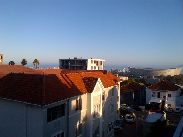
img-20170120-00030
An early morning from our balcony

One day recently, on my usual daily walk past the rugby grounds, I noticed that several huge tents were being erected and each day after, more and more tents were being added.  The event was the Cape Town rugby 10s tournament, also incorporating a netball and beach volleyball competition.  All in all, there were 100 rugby teams, 40 netball and 40 volleyball, all competing over three days.

Now I have played in a few rugby 7s competitions, in my very amateurish and much younger days, but I had never heard of rugby 10s.  The game involves ten players on each team – five forwards and five backs, and each game has two 9-minute halves, with a 2-minute half-time.  The rules are similar to rugby 7s.

And typical of anywhere one finds rugby, copious volumes of beer were consumed, and the Cape Town event sported, what was reputed to be, Africa’s largest beer tent.

a083e1ccf462a339666547d9cf587d8c-img
The rugby event, as seen from the air (photo from internet)

Two days later, the tents, and all evidence of the rugby event, had disappeared, to be replaced, outside the football stadium and surrounding roads, by the construction of temporary facilities for the Cape Town leg of the Triathlon World Cup.

This event is held over two days, month by month, in several cities in both hemispheres.  There are four categories in the competition, with the elite competing over 750 m swim, 40 km cycle and 10 km run.

dates
The swim in the cold water of the Waterfront harbour (photo from internet)
1-7
The cycling over laps along Beach Road (photo from internet)
maxresdefault
The eventual first and second in the elite female category (photo from internet)
lucy-hall-jessica-learmonth-700x394
With a sprint to the finish by the football stadium (photo from internet)

As with the rugby competition, all evidence of the complex facilities had disappeared within two days.  On the third day, I found several strange metal strips on the forecourt near the stadium, each with protrusions at intervals.  There were two groups apart, but at angles to each other and not parallel. I was quite puzzled.

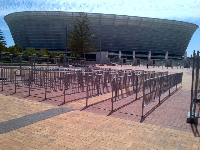
The next day, I found that barriers had been added, but I still could not imagine what they were for.  This time I found a park employee, who explained that when there was a football match in the stadium, the whole area was fenced off, and all spectators had to pass through the barriers to be searched for alcohol, drugs, knives, guns etc.

Sure enough, the next day I found that the whole area had been fenced off.  It was not obvious at the start.
img-20170218-00034

This weekend, there is a limited-overs cricket match taking place.

img-20170218-00036

And of course, tonight there will be the football match at the stadium.

It seems that there is never a dull moment in Green Point.

I like it like that… 🙂

Mérida to Cáceres

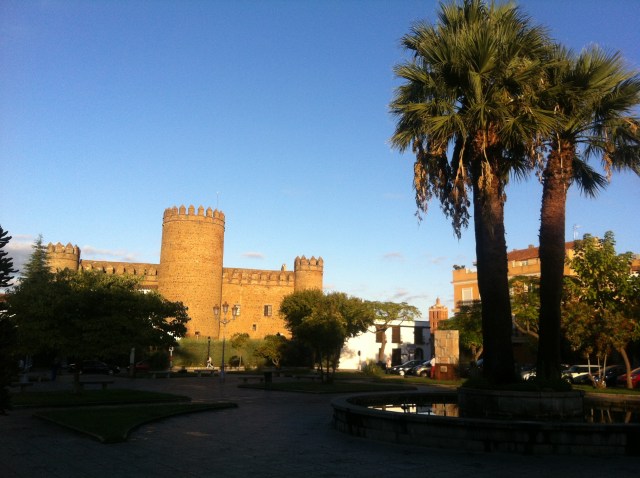
We decided to continue as far as Cáceres, some 74 km to the north of Mérida, spending the nights in Aljucén, Alcuésar and Aldea de Cano.

About 5 km north of Merida, we passed around the Proserpina dam – El Embalse de Proserpina.  It was built in the early days of Mérida, to supply water to the city across aqueducts.  The aqueducts have long been in ruins, but the reservoir, with its 12m retaining wall, still exists.

img_2871
El Embalse de Proserpina

At one point on the route, we saw in the distance the couple with the cart.  She was strapped in and hauling, while he was ahead, walking with a perceptible limp.  A little later we passed them: they were sitting some distance from the path.

Aljucén is a very small village with one bar and a rather strange Casa Rural – Termas Aqua Libera, at which we turned out to be the only guests.  From the street, there was nothing unusual about the place, but once across the threshold, one was transported to Roman times.  It seemed to be quite an authentic copy of a Roman villa, and we were shown where we could select from a choice of Roman togas to wear, if we were interested in dressing the part.  We respectfully declined the opportunity.

When we went out some time later, there seemed to be a party going on, with several couples dressed in Roman gear, with lots of flashing legs and thighs.  But when we returned a couple of hours later, all was quiet, much to Lotta’s relief and my disappointment; I had never before been to a Roman orgy and I still haven’t.  One can but live in hope… 🙂
The highlight of the next day was our encounter with the pigs, black pigs, hundreds of them, in a huge open range paddock: the black pigs that produce the famous pata negra ham.  The black Iberian pig, or cerdo negro, are apparently the only pigs that naturally seek out and eat mainly acorns.

img_2877

But like most pigs, they are very curious, and want to smell you and perhaps taste the salt on your legs.  Now I was brought up with pigs, so nothing new there, but I suspect that Lotta would have preferred to have seen them from the other side of a fence.  She was quite happy to eventually cross a cattle grid and leave that massive paddock.

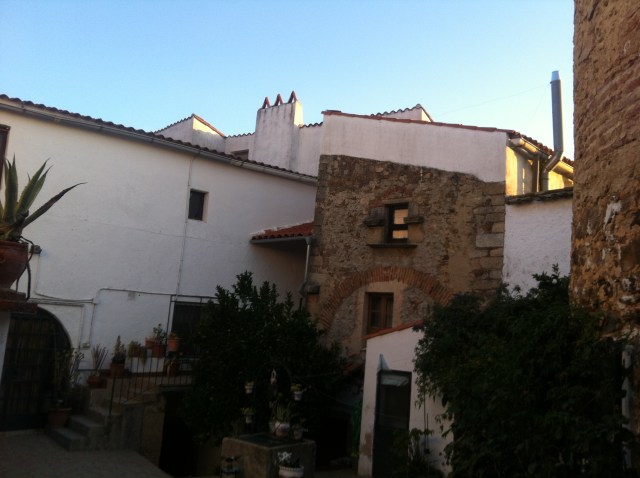
The place where we stayed in Alcuésar was also quite strange.  I had only vague instructions that led us nowhere, so we stopped in a bar to ask directions.  After another caña, the very helpful barman drew us a simple map on a serviette: it turned out that we had been quite close, but not close enough.

But when we found the street and the right block, we could not see a door.  I asked an old toothless man if he knew where the entrance was and he immediately scuttled up a side-street and rang a door bell, signalling that we had arrived.  An elderly aristocratic-looking lady answered the door, hustled us in and in a whirlwind of introductions and instructions, swept us in and out of rooms, up stairs, down steps and along corridors until we were in a small apartment that was ours for the night.  I was quite disorientated.

Thankfully our exit was close by, via a side door of the house, which it turned out occupied an entire block of the town.  It must have been a rich family that built the house and perhaps the aristocratic lady was a descendant.  We never did see her again.

We managed to navigate our way from the apartment into the town and back again, without once getting lost.  And when we returned, who did we see watching television as we passed a large room that served as a lounge?  The couple with the cart!

img_2879
Somewhere in the house was the little apartment

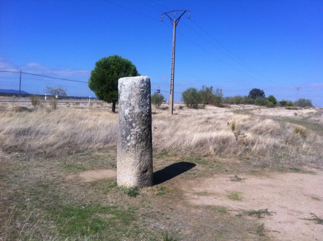
Between Alcuésar and Aldea de Cano, we came across several Roman milestones.  A Roman mile was the distance that a legion would march 1000 paces, a pace being each time the left foot struck the ground.  It was the origin of the English mile, and each Roman milestone had its distance from Rome engraved on it.

img_2881
A typical Roman miöestone

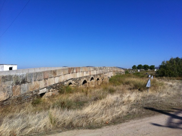
Prior to Aldea de Cano, we passed through an extensive area with bridges and stepping stones, even though the ground was bone dry.  Apparently, it was a swamp when it rained.

img-20151014-01116
Dry, but sometimes  not so…

img_2884

When we arrived in Aldea de Cano, there was a sign on the door of our Casa Rural to say that our hostess would not be there until two hours later.  So, we settled ourselves down in the sun, outside a nearby bar, and quenched our thirst and ate some tapas.  We were soon joined by an old farmer, who obviously already had had a few drinks. He was delightful company.  At one stage, he disappeared and emerged with some more beers for us, and later I reciprocated.

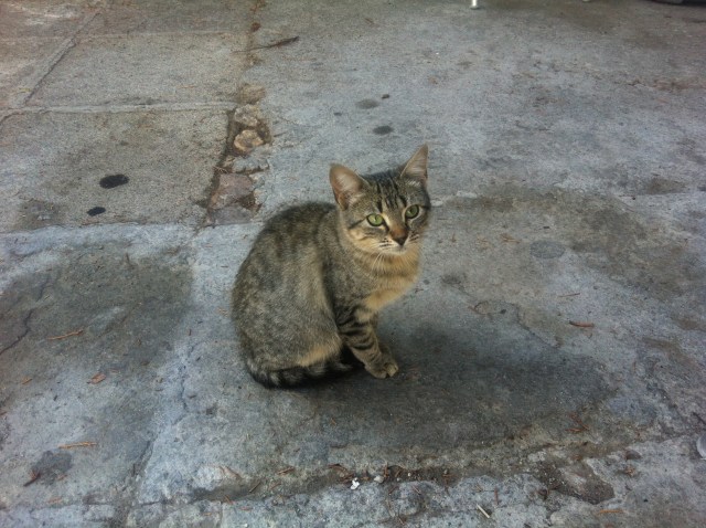
In the meantime, we had been joined by a little kitten.  It watched us, but never got close.  When I tried to stroke it, it quickly retreated.  The farmer said that it was a street cat and he wanted one for his farm, to keep the vermin under control.  He tried to tempt it to come close, but to no avail.

img_2883
The rodent hunter

That night we finally met the ‘strange couple with the cart’.  I had arranged for the owner to serve us dinner, and when we sat down, the couple emerged from a nearby room.  It turned out they were indeed German, quite shy, but passionate about hiking.  He was a web developer, quite a ‘geek’ and I don’t recall what she did.  They did not live together, but were ‘married’ in their passion for hiking.  I rather liked them.

The next morning, we left early and stopped at a bar on the edge of the village.  And who came in, just as we were about to leave?  Nope, wrong this time.  The old farmer, he of the kitten, arrived to have his early morning drinks with his mates, before setting off to his land.   I’ll never forget how his face lit up when he saw us and I am sure that mine was a mirror image.  We chatted for a few minutes before we had to set out.  The memory of the old farmer is ingrained in my memory.

The path to Cáceres was long, but uneventful, and eventually we wended our way through the industrial suburbs and the centre of the city, and finally up the steep hill to the Plaza Mayor and the old city.  Our hotel was just off the Plaza Mayor.

img-20151016-01117
The old city from the Plaza Mayor

img-20151016-01120

img-20151016-01125

The weather was starting to get quite cold overnight and we were not equipped for late autumn in Northern Spain.  To come, there would have been the historic cities of Salamanca and Zamora, but they would have to wait for another day.  So, we headed to Madrid, and eventually back to Uruguay.

Mérida

When I first started walking to Santiago de Compostela, I was aware of the legend of Saint James, one of Jesus’s disciples; of his preaching in north-western Iberia; of his eventual return to Jerusalem, his arrest and beheading; of his two faithful followers taking his body to Galicia, and his interment there.  But to me, it was just a legend, an interesting tale, but bearing little relevance to any historic events.  To me, Galicia seemed a long way from Jerusalem.

But until I went there, I had not realized how developed and sophisticated was that part of Europe in that era, with its nearly 1000 km of straight paved road, running from south to north, allowing the rapid movement of armies and the transportation of gold, silver, other minerals and crops to the waiting ships in the south, and on to Rome.  I had seen Roman ruins in Astorga in the north and Sevilla in the south, but walking on the former Roman road for day after day, and seeing the remains of the Roman city of Mérida, caused me to change my view: perhaps there was some credence in the legend of Saint James.

We walked across the Puente Romano on a beautiful early autumn afternoon, past the Muslim fort, and up the hill to the old town.  I had reserved the same hotel, where two years previously I had become stuck in the elevator, and was eventually hauled up and out by the owner.  It was no surprise that he had no hesitation in remembering me, when we checked in.  And he assured me that he had had no further problems with the elevator since my incident, but just in case, he gave us a room on the ground floor.

The modern city of Mérida has been built on top of the walled Roman city of Augusta Emerita, originally founded in 25 BC, in the reign of Augustus.  Hence the origin of the name.

img-20130925-00698
A model of Mérida, as it was in Roman times

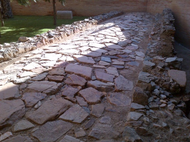
The original Roman street and block layout has been maintained, and there are several places in the city where one can see the original street surface.

img-20130925-00697
A section of an original Roman street

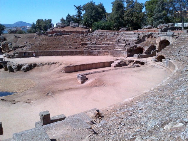
Mérida had an impressive amphitheatre and an adjoining theatre, the latter which has been partially restored and is still used for productions.

img-20130923-00660
The amphitheatre
img-20130923-00665
The stage of the theatre
img-20130923-00668
And the restored seating

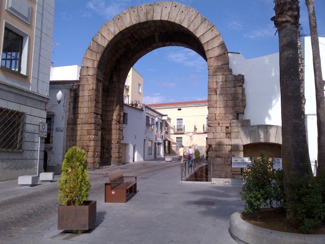
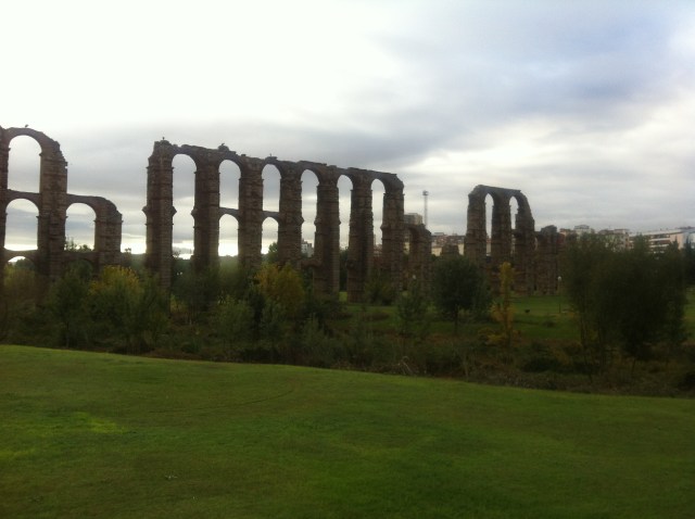
Throughout the city there are several other impressive Roman remains, including Trajan’s arch, the Temple of Diana, the aqueducts, and outside the original walls, the well-preserved circus used for chariot racing.

img-20130924-00673
Trajan’s archTrajan’s arch
img_2866
Temple of Diana
img_2870
The remains of one of the aqueducts that carried water to the city, seen just after sunrise
vr_merida_03
The Mérida circus (photo from internet)

After the fall of the Roman Empire in the 5th century, the Visigoths replaced the Romans, and they in their turn were conquered, in the 8th century,  by the Muslims from North Africa.  The Islamic control of Mérida lasted until the 13th century, when they were defeated by the Christians.  At Granada, in 1492, the last resistance of the Muslims in Spain was eliminated.

img-20130925-00694
The Alcazaba, the Muslim fort, as seen from an island in the river
img-20130924-00680
The western wall of the Alcazaba, as seen from the Puente Romano

In the legends of Saint James, there is no mention of the route he may have taken on his return to Jerusalem, but it is likely that such a traveller from North-western Iberia would have passed through Mérida on the way south, to continue by boat to the Eastern Mediterranean.

I remain to be convinced that the legends of Saint James are anything other than legends, but I need no convincing that Mérida is a most interesting city.

Zafra to Mérida

8-10 October, 2015

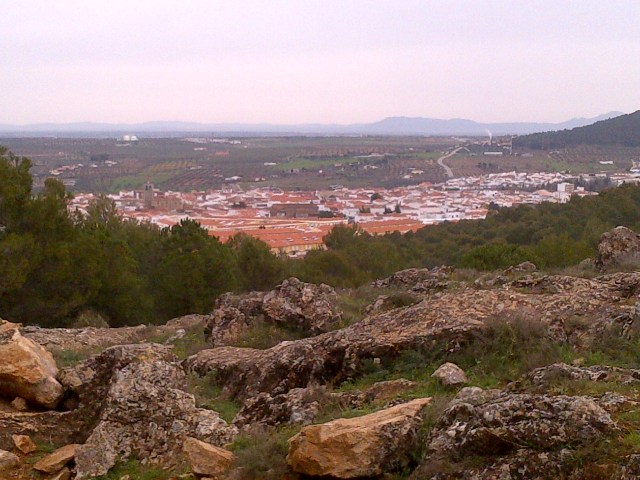
Once outside Zafra, the route climbed steadily to a ridge overlooking Los Santos de Maimona.  From the summit, one could see the plain stretching to distant mountains.  Mérida lies 65 km to the north of Zafra and takes three days of walking, spending the nights in Villafranca de Los Barros and Torremejía.  Once again, between the overnight villages, there was nothing but occasional farmland and bush.

img-20130304-00481
Looking down on Los Santos de Maimona

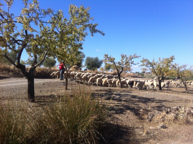
The land was parched.  It looked as if it had not seen rain for a long time.  At one time, after Santos de Maimona, we came across of a flock of sheep.  The shepherd walked ahead, seemingly oblivious of what was following him.  Four sheep dogs raced around, rounding up the stragglers and keeping the flock moving in the general direction of their master.  It was not the first time that I have witnessed the shepherd-to-dog relationship, and I have never ceased to be impressed.

img_2831
The shepherd leaving, the flocking following

From Villafranca de los Barros to Torremejía the path was straight, following the old Roman road.  There is absolutely no shade, just grape vines and occasional olive groves as far as the eye can see.  In one part, the road was being resurfaced, and for several kilometres we had to trudge through a thick layer of uncompressed dust.

img_2844
A repaired through the vines

On a long straight path, with no bordering trees or bushes, one’s progress across the landscape is barely perceptible.  The goal is there on the horizon, but on the horizon is where it seems to remain.

img-20130921-00654
In the distance Torremejía


But eventually one arrives.

img-20130921-00655
Grapes on their way to being pressed
img-20130921-00657
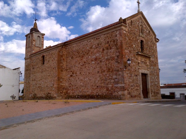
The recently renovated Iglesia Parroquial in Torremejía

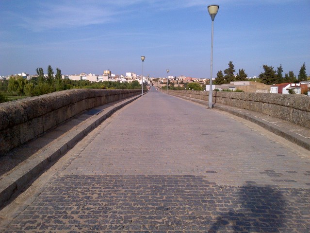
The next day was relatively easy and, in the early afternoon, we arrived at the Puente Romano, that leads across the river Guadiana to Mérida.

At 790 m, it is the longest surviving Roman bridge.

img-20130924-00682
The Puente Romano over the river Guadiana, with its 60 surviving spans


img-20130924-00683
The restored and pedestrianized Puente Romano


Next: Mérida

Guillena to Zafra

2-8 October, 2015

The path north from Guillena to Zafra covers 125 km and passes through five villages – Castilblanco, Almadén de la Plata, El Real de la Jara, Monestario and Fuente de Cantos.  The villages are between 15 km and 27km apart, a distance that a hiker, carrying a backpack, can comfortably cover in a day.  Originally it would have been the distance that a heavily armed Roman soldier would have been expected to march.  Apart from some farmland adjacent to the villages, the countryside was empty of habitation.

img-20130227-00462
A cork plantation near Castilblanco

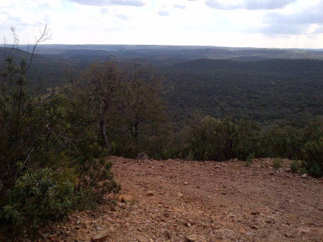
For the first three days, the path wound through the rugged Parque Natural de la Sierra Norte to El Real de la Jara, shortly before passing from Andalusia into Extremadura.  There was a long climb to Monestario, after which the landscape transcended onto the plains that surround Mérida.

img-20130227-00468
Looking back from a ridge, before descending to Almadén de la plata


img_2742
And the path down to Almadén de la Plata

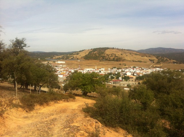
Apart from Zafra, which is a large town with a rail and bus station and several hotels, the villages that we passed through were small, each with its church and a small central plaza, an hotel or rural hostel with a few rooms, an albergue with dormitory accommodation, a bar, and little else.  And the houses and buildings were universally painted white, with red tiled roofs.

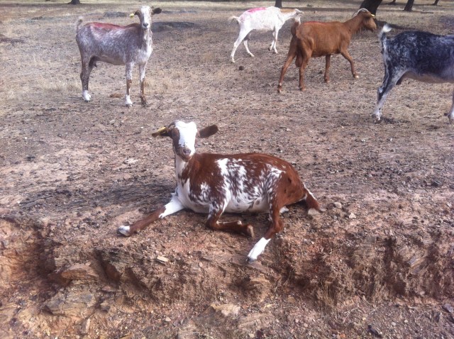
In the first three days, where the landscape was more rugged, the path led through many huge paddocks, where herds of cattle, pigs, goats, sheep and horses ranged free.

img_2758
Free-ranging goats


img_2763
Pigs looking like hippos, with their own pool
img-20130301-00473
El Castillo de las Torres (XIII century) outside El Real de la Jara

After Monestario, the land flattened, and the farming changed from mainly animals to crops, with occasional olive groves and grape vines.  The path was dusty and the land parched; it seemed as if it had been since the last sustained fall of rain.

img_2819

In the seven days that we walked from Sevilla to Zafra, the only other hikers that we saw were the strange couple pulling the cart; we had seen them arriving in the bar in Guillena and pulling their cart up the stairs to their room.   We passed them a couple of times on the path, when they were sitting in the shade, resting or having something to eat and drink.  They seemed to be quite shy, or perhaps they just wanted to be alone.  I can well sympathize with the latter.

We always knew when they were ahead of us, when we spotted the tracks that the wagon tyres left in the dust.  And each night we usually saw them arrive in a village, sometime after we did.  On a couple of occasions we saw them enter the same hostel where we were staying, but they were quite reclusive and stayed in their room.  I thought that they might have been on their honeymoon.

When we were on our way out of Zafra, we stopped at the bar of a comfortable hotel to have a coffee and a croissant, and who walked out of the restaurant and up the stairs but the strange couple with the cart.

Little did we know that we were to see them every day until Cáceres.

img_2825
Leaving Zafra and passing the castle in the early morning sun


Next: The former Roman city that is now Mérida

Sevilla to Guillena

Sevilla to Guillena (23 km)

Thursday, 1 October, 2015

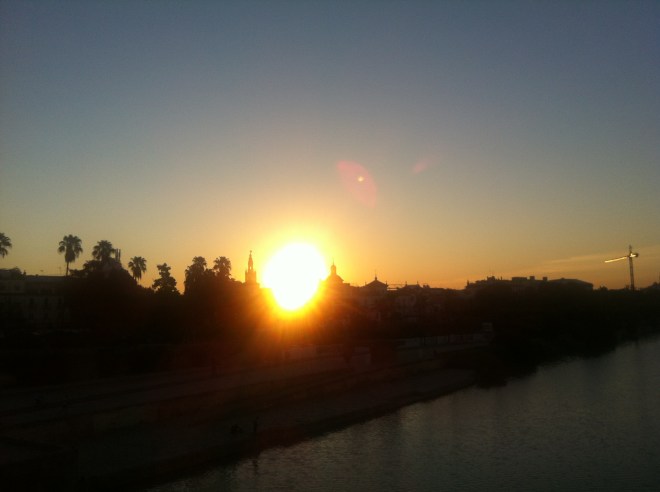
We set out early, before dawn, and took the metro to close by the cathedral.  From there our camino began.  We walked along the river and when we reached the Puente de Triana, the sun was rising; the buildings to the east were in silhouette and those on the west were bathed in rose light.

img_2713
Looking back across the river from the Puente de Triana
img_2714
And looking forward to the Castillo de San Jorge, with the moon clearly visible

The route took us through typical industrial suburbs and abandoned lots, rather depressing, but typical of large cities anywhere in the world.

About 10km from the centre of Sevilla, we passed through the small town of Santiponce, largely built on the former Roman city of Italica, founded in 206 BC.  One can visit the amphitheatre that once held 25,000 spectators.

italica
The amphitheatre of Italica (photo from internet)

Two of the best known of the ‘good’ Roman emperors – Trajan and Hadrian, were born in Italica.  Trajan was known for his public works and his expanding Rome to its maximum territorial extent.  Hadrian followed Trajan and is best known for the wall he had built across northern England to keep out the Scots.  Ironically these days, many Scots would like to have the wall rebuilt to keep out the English.

When we finally reached the end of the industrial zone, at a large roundabout, we were confronted by two attractive women, bent over and baring their bottoms to passing cars and trucks.  Until I greeted them with ‘Buenos días señoritas‘, they were not aware of our passing presence.  Sevilla has its unique way of welcoming visitors to its city.

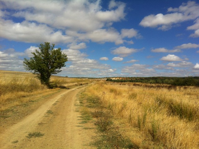
From close to that roundabout a long straight undulating dirt road led to Guillena.  From the top of each incline one could see the town in the far distance, but after each hour of walking, we scarcely seemed to be any closer.

img_2717
The long straight road to Guillena

We passed the hollow, where two years previously the road had been waist deep in flood water, and where I had slipped and got very muddy and wet.  It was bone-dry, with no hint that a stream had ever existed.

img_2718
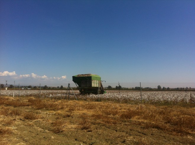
Harvesting cotton outside Guillena

Later, when we had checked into the only hostel in the village, and were having a beer in the bar downstairs, we witnessed a strange couple enter and inquire about a room.  He was tall and very thin and she was short and quite plump, and neither of them spoke Spanish.  They were both heavily dressed, considering that it was a warm day, and he was strapped around the waist to the handles of a cart, which was piled with bags and camping gear.  It was almost comical to witness the two of them hauling the cart up the stairs to their room.  I would have loved to have captured the incredulous looks on the faces of the locals in the bar.

Every day brings a new experience on the camino.

Next: Castilblanco de los Arroyos

Sevilla

Sevilla

29-30 September, 2015

We were not long back from our four months in Chamonix, when I started to plan our next long hike along one of the pilgrimage paths that eventually arrive in Santiago de Compostela.  My mind was set on walking across France, from Geneva to Saint-Jean-Pied-de-Port, via Puy-en-Velay.  I booked flights from Stockholm for 28 September and started to plan the stages of the walk.

But I had nor progressed very far in my planning, before I realised my potential mistake; we would be crossing the Massif Central, the mountainous south-central part of France, in late October, when the weather could be quite cold.  And as I don’t ‘do’ cold, I switched my attention to the Vía de la Plata, that starts from a much more temperate Sevilla.  And conveniently there was a low-cost morning flight from Geneva to Sevilla on 29 September.

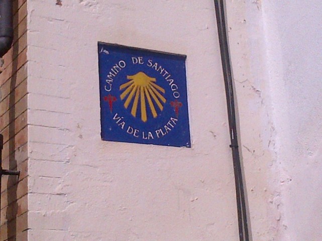
The Vía de la Plata is the longest of the pilgrimage routes in Spain, heading north from Sevilla to Zamora, then north-west to Santiago, a total distance of about 1000 km.  Much of the route is on ancient Roman roads.  The route was also known as the Camino Mozárabe, originally followed by the Christians of North Africa.

img_2725
Vía de la Plata

I was no stranger to the route from Sevilla.  In mid-February of 2015, I had set out to walk from Sevilla.  The temperature was perfect for hiking, but my start was delayed for nearly a week by torrential rain.  When I eventually got going, I found low-lying areas to be flooded, streams with stepping stones to be deep under water, and mountain paths washed out.  Twice I slipped and fell in the water, and when I reached Villafranca de los Arroyos, the heavy rains started again.  The forecast was for rain, rain and even more rain for the week ahead and extensive flooding.  I decided to abandon the walk and return another time.

My second attempt was in late September of the same year, but this time it was in soaring temperatures and with little or no shade.  When I walked into Mérida the temperature was 42 °c.  The heatwave showed no sign of abating, so I once more stopped.

But ‘Stubborn’ is my middle name and back to Sevilla I went once more, this time with Lotta.  It was her first time in Sevilla, so we spent the first day seeing some of the sights.

The central core of Sevilla is a labyrinth of narrow streets branching out from the massive cathedral.  Some of the lanes are so narrow that one can stretch out ones’ arms and almost touch the walls on each side.  The lanes twist and turn, and despite being close to the cathedral, one cannot see it until one exits the maze.

The cathedral is the third-largest church in the world and is the burial site of the alleged bones of Christopher Columbus.  It has fifteen doors on its four facades.  It is so extensive that it can only be seen in its totality from the air.

img_2686
Part of one of the facades of the cathedral

Sevilla is a popular tourist destination, for it is an interesting scenic and historic city.  But one of the downsides of exploring the tourist area is being the constant target of touts trying to entice one into restaurants, sell tickets to flamenco shows, rides in a carriage etc.

img_2667
Coches de Caballo – Rather expensive tourist traps

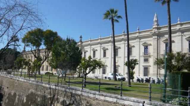
One of the largest buildings ever constructed in Europe was the Royal Tobacco Factory.  It measures 250 m by 180 m and was built in the mid-eighteenth century.  It was the first tobacco factory in Europe.  Since the 1950s, it has housed part of the University of Seville.


02_big
The Royal Tobacco Factory (picture from internet)

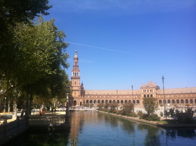
The magnificent Plaza de España was built in 1929 and was the central feature of the Ibero-American Exposition, held to strengthen the ties between Spain, Portugal and their former colonies.  The building is semi-circular and features a canal crossed by several ornate bridges.

img_2696
A view of one of the symetric ends of the building


img-20130220-00441
And one of the pairs of bridges crossing the canal


The building has 58 pairs of benches, each one representing a province of Spain, with a typical scene from the province and a map, all surfaced in painted ceramic tiles.

img_2698

And at the end of the day, a timely reminder of why we were in Sevilla…

img-20130222-00455


Next: Seville to Castilblanco de los Arroyos

Papillon

Perú, 1977

It was in the very early 1970s that I read ‘Papillon’, the alleged memoirs of Henri Charrière, the French convict, who escaped from Devil’s Island off the coast of French Guinea, and who ended up, years later, in Caracas.  I once went to his restaurant in Baruta, just outside Caracas, but by then he had died.

In his memoirs, he wrote of his experiences in escaping from the notorious prison on a raft built of coconut shells, eventually landing on the Guajira Peninsula on the coast of Colombia.  There, for some time, he lived with two Indian women.  Whether factual or not, the account had no small part in my desire to travel and to experience something of Central and South America.

In 1976, I travelled across the Pacific on a Greek passenger ship, from Sydney to Panamá, via Auckland and Paapete (Tahiti), and eventually on bus, country by country, through the plethora of Central American countries, to the US, eventually ending up living by the beach at Marina del Rey in Los Angeles.  There I was able to rebuild my savings by working at odd jobs, mostly dirty tasks that were uninteresting to the local unemployed.

But the great consumer society held little attraction for me, and a few months later I headed back south, intent on going as far as my meagre savings would allow.  In those days, local bus travel was relatively inexpensive and basic accommodation was easy to find.

When I reached Panamá, I was unaware that the roads ended there, and that there were none south through the Darien Peninsula; there was, and still is, a 160 km gap in the 48,000 km Pan-American highway, that runs from northern Alaska to the southern tip of Argentina.  The only way of crossing from Panamá to Colombia was by plane, or by boat, east along the Caribbean coast, or south along the Pacific.  I flew to Medellín and from there continued on by local buses, hopping from place to place through Colombia and Ecuador to Perú.  Early Christmas day found me on a bus heading south from Lima.

With its colonial walls built from white volcanic stone, I found Arequipa to be a most impressive city, especially in the Convent of Santa Catalina.  And in Puno and Lake Titicaca, at 3827 m, with its floating islands and colourful Indian culture, I felt as if I was in a completely different world.  But sadly, my funds were running low, and as much as I wanted to continue into Bolivia, I had to turn back north.

arequipa_009_800x450
Arequipa,with Misti in the background
puno-3
One of the floating islands off Puno

Unfortunately, the next morning my funds became more depleted.  As I was boarding the train to Cuzco, I became involved in a scuffle between some men trying to leave the train and as others trying to board.  It was eventually resolved, but fifteen minutes later, I realized that the money that I had had in my pocket was no longer there.  I had been robbed.  Fortunately, I had money in a dirty sock in my bag and some more in the sole of my shoes, about enough to get me back to California.

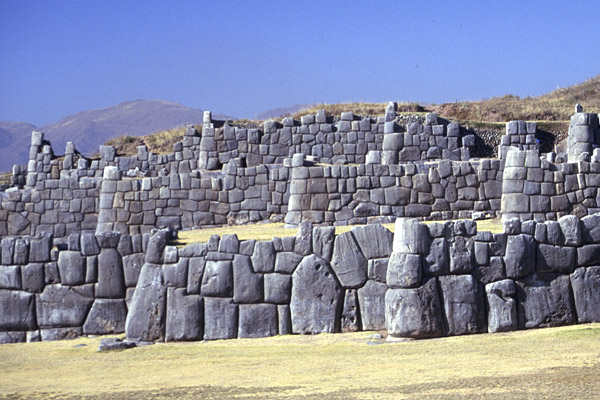
I loved Cuzco and I would have stayed there much longer if I could.  The Inca history, with the Spanish culture imposed upon it, I found most fascinating.  During my first morning there, I went to a bookshop to thumb through a local history book – I could not afford to buy it.  I overheard an elder American tourist asking if they had any postcards of sexy women.  I was all ears, for the man looked as if he would have had apoplexy if an attractive woman passed within 100 m of him.  It turned out that he was referring to the ruins of Sacsahuaman, a fortress just outside Cuzco.

The next day I went there and what an impressive monument it turned out to be, with its massive walls built with huge multi-sided stones, all fitting together as in a jig-saw puzzle, so tightly fitting that a thin knife could not be inserted between them.

1044

Few people go to Cuzco without also taking the day-trip to Machu Picchu, and I was no exception.  The train was heavily fortified, with many armed soldiers.  Once there, I ignored the buses that traveled the zig-zag road to the ridge, but climbed up the old Inca trail.  After wandering the impressive ruins, I tried to climb up to the peak that overlooks Machu Picchu, but a heavy thunderstorm cut it short, otherwise I could have easily slipped and slipped on the greasy stones and ended up in the Urubamba River a long way below.

machu-picchu-ciudadela

With regret, I left Cuzco on a ramshackle old bus, destination Lima.  I was the only ‘gringo’ on the bus, but I had the consolation of a seat beside a beautiful young Indian girl.  Unfortunately, she spoke little Spanish and I spoke even less. All day we seemed to be descending into a valley with a steep ascent on the other side.  The bus coughed and wheezed and seemed to be on its last legs.  It was dark when progress ground to a halt.  For a while we all sat and waited, while the driver fiddled with the engine.  Eventually, one by one, we all descended to stretch our legs and empty our bladders.  The sky was clear and the stars were crystal clear, but it was very cold.

I was wearing only shorts and shirt and I was not prepared for cold.  But the lovely little Indian girl offered to share her blanket with me, and I gratefully accepted.  I eventually understood that she was a maid in a house near Lima and that she was returning from a short holiday with her family in Cuzco.

As the night wore on and the bus remained stationary, the occupants slept, and the driver and his assistant continued to fiddle with the engine.  It was more comfortable if I put my arm around the girl, and she soon slept with my other arm around her waist. Eventually at some time in the night, the engine roared into life and we jolted and jerked our way closer to Lima.  And we kissed in the dense night light.

The morning came too soon; I felt as if I could have spent the rest of my life with my arms wrapped around that little Indian girl, but it was not to be.  Her destination arrived, she descended, we kissed a long time and she walked away.  She never looked back.  As she turned a corner, I wanted to run after her, but my courage failed me.  I climbed back on board the bus.

I have often wondered if Henri Charrière ever had the same regret when he left the Indian sisters on the Colombian coast.

Lucy Ann

I was 42 when I first became a father. To say that the news ‘rocked my boat’ would have been an understatement; it was more like a tsunami hitting me. I had never had any roots, and if any had ever started to sprout, I moved to new pastures.  If I ever thought about having children, I would have dismissed it as something that might happen one day, but not just yet.  I was a nomad at heart. Some would say I still am.

But I eventually got used to the inevitability of fatherhood, although I could only ever envisage having a daughter.  I was never ‘one of the lads’; I loved women and their company. The idea of having a smelly little snot-nosed son did not much appeal.

Eventually ‘launch day’ arrived and the only name for the baby that we had considered was Lucy Ann.  If the baby turned out to be a boy, we would cross that bridge when we came to it. At least that was how I remembered it.

So, the baby had no name for the first couple of days, until someone in the hospital suggested the name Andrew, as he was born on Saint Andrew’s Day.  I happily agreed and added Douglas, which was my own second name and my mother’s maiden name.

It was not until after a couple of days at home that I was left alone with Andrew, while his mother went grocery shopping.  Predictably the door had barely closed, when he evacuated his little bowels, and left me in previously uncharted territory.  By the time I had completed the clean-up, he and I were the best of friends and all that winter, during the weekends, he used to lie in my arms, while I watched rugby and other sports on the television.

Then there was Robert Charles, again not a girl, followed by John William, most definitely not a girl.  When Philip James was born, the idea of a daughter called Lucy Ann was abandoned; four children under seven is quite a handful in any society, especially when there are no relatives to help out.

lyndhurst-school-photo-5-page-001
Clockwise from the left – Andrew (Barcelona), Robert (Barcelona), John (London) and Philip (Basingstoke)

So who was Lucy Ann, after whom I had wanted to name a daughter?

Lucy Ann English (1846-1934) was one of my great grandmothers.  She was married to William Blackwood of Hethel, about whom I mentioned in a previous article.  I have no idea what her name appealed to me, but I loved the sound of it.

She was born and raised in Mulbarton, a few kilometres south-west of Norwich.  She had a younger brother, James, born in 1849, but two years later her mother, Lucy, died in Thorpe Lunatic Asylum of an internal hernia.  Perhaps it was the result of a difficult birth.  Lucy Ann’s father remarried in 1856, but his new wife died less than three years later.

english-lucy-6-nov-1851
The death certificate of Lucy English, formerly Lucy Baldry

Lucy Ann’s grandfather, James English (1788-1861), lived in the same village with his third wife, the previous two having died.  When I was researching this branch of my family many years ago, I was unable to locate James in the 1841 census, but found him in both the 1851 census and that of 1861.  It puzzled me, for he was nowhere to be found in the UK.  I wondered if he had gone abroad for a few years.

It was not until quite recently that I discovered where he was in 1841.  He was not with his wife in Mulbarton for a very good reason.  He was in the County Gaol & House of Correction of Norwich Castle.  At the Count Session of 30 June, 1841, he was convicted of larceny and sentenced to imprisonment.  He was perhaps lucky to have been imprisoned in England, for up until a few years earlier, he might have been transported to a penal colony, such as Australia.

Lucy Ann would have known her grandfather, James.  She was 15 when he died.  I have no idea if she knew of his imprisonment, but I suspect that, in a small village, it would have been common knowledge.

There are many James in my ancestry, both in England and in Ireland.  In his second name, my youngest son carries their memory.  Many Australians are proud of having been descended from a convict.  In its way, it is a form of inverted snobbery.

I can identify myself with that.

Hethel

It was in mid-1985 that I first became interested in genealogy.  My mother had recently died and I realised then how little I knew of my ancestry.

My father was of no help in getting me started on my research; he said that he knew no more than I did.  He left home when he was 16 and it is quite probable that his parents never told him some of the less-than-flattering facts about some of their numerous siblings, facts than I subsequently encountered.  His parents were a very Victorian couple.  For many people of that era, illegitimacy, unmarried cohabitation, and divorce were scandalous and best not spoken of.

Both my parents were only-children, so I had no uncles or aunts to turn to for their possible input.  I had to start from scratch.

In 1985, family research was both time-consuming and relatively expensive, compared to recent years.  There were no computers, no databases, no software and no internet.  Research was carried out on the original documents and charts of ancestry were drawn by hand.  One wall of my study was eventually covered with a huge chart holding 2+4+8+16+32=62 ancestors for each of my parents.

As the records for Ulster were held in Belfast and I was living south-west of London, I started my research with my father’s ancestry.

He was born in Norfolk, as were both of his parents.  The records for English births, marriages, deaths and census returns, dating back to 1837, were held in London, and over many months and numerous visits, the chart on my study wall began to fill up.  And as far back as 1837 I found that all my father’s parent’s ancestors were also born in Norfolk.

To go back before 1837, one had to visit the relevant county record archives, which in my case meant a long drive to Norwich and an overnight stay.  Once having obtained a reader’s permit, one could submit a request to have access to the original documents of a given parish and 20-30 minutes later, they would arrive from the archives and  research could begin.

Initially I concentrated on the Blackwood line and after a couple of visits I found that four generations of my father’s ancestors had lived in the two adjoining parishes of Hethel and Wreningham.  The oldest event that I found was the marriage of my great (x4) grandfather, Robert Blackwood, in Hethel in 1756.

To this day, I have not been able to locate his birth.  Every line on an ancestral chart eventually ends in a brick wall, and breaking one down inevitably leads to two more.

Hethel was a small parish with no village as such, just an ancient 11th century church, and a handful of farms.  In 1841 there were 211 inhabitants, but by 1901 the population had dropped to 153.  In 1841 there were 15 Blackwoods living there, but by 1881 there was only one, my great great grandmother. She died in 1889.

An airfield was built there during WW2, after which it was closed. Today it houses Lotus Cars.  Hethel is also known for having an ancient thorn tree, reputed to be more than 800 years old, the oldest on record.

Hethel is about 10 km south-west of Norwich and it was on a beautiful summer day in 1986 that I first went there.  It is not on a main road, and is only accessible down narrow country lanes.  When the trees and hedgerows are in full leaf, it is easy to miss the turning.

I parked beside the church gate and went in.  The graveyard was largely uncared for, the grass was long, and there were several large clumps of nettles.  I had a very strange feeling that I had been in that graveyard before, but of course that was impossible. It was probably just the nervous anticipation of finding evidence of my ancestors.

I did not start looking at the nearby gravestones, but went straight into a clump of nettles away to the left of the entrance, and with my foot trod them aside, to fully reveal two adjacent gravestones.  They were the graves of my great great grandparents, Robert Blackwood (1809-1867) and Susanna Ringwood (1811-1889).

Of course, most people would say that it was just a coincidence that I went straight to those graves, but I am not so sure.  I clearly remember feeling as if I was being led directly to them.

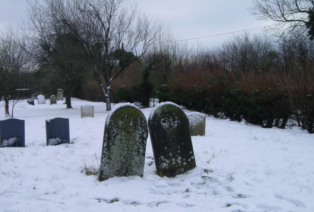
I have been back to Hethel twice since then, the last time in an overnight snowfall, just before Christmas.  There was a strong easterly wind blowing and it was bitterly cold.

dsc00003
All Saints Church, Hethel

There were no leaves on the trees and of course no nettles.  The graves of my great great grandparents were clearly visible, leaning to one another, as if she had moved closer to him for warmth, sleeping on his shoulder.

dsc00007
The graves of Robert Blackwood and Susanna Ringwood

The inscriptions on the gravestones are now very eroded and difficult to read.  One day in the not distant future they will be completely illegible.

Neither of my great great grandparents could write; they signed their name in the parish registers with a mark, an ‘X´.  They were undoubtedly poor – he was an agricultural labourer, and he died at the age of 59, whereas she lived for another 22 years.

It was possibly their son, my great grandfather, William Blackwood (1847-1927), who had the gravestones erected.  He was the first of the Blackwoods to be able to write and he worked as a miller, with his own mill in Harleston, 18 km south on the Essex border.

harleston-mill
Harleston Mill


I once came across a beautiful expression in a book I was reading:

Existimos mientras alguien nos recuerde (We exist as long as someone remembers us)

If I ever succeed in publishing, in some form, my series of articles,  perhaps one of my descendants will one day read this, and be motivated to visit the churchyard in Hethel, as I first did, now more than 30 years ago.

And in so doing, our family links with the past will be refreshed, and some of those who came before us will be remembered.